Data escursione: 31 Luglio 2010
Quota partenza (m.): 2.100
Quota arrivo (m.) : 3.538
Dislivello complessivo (m.): 1.438
Durata : 2h 16m (tempo medio 3h00m/3h30m)
Difficoltà : EE (Escursionisti Esperti)
Esposizione: Sud
Località partenza : Inizio teleferica per Cà d'Asti (poco prima del Rif.La Riposa) - Mompantero - Valle di Susa (Piemonte)
Partecipanti: Io & Fiorita
Per continuare l'allenamento alla quota non potevo farmi mancare la vetta più alta della Valle di Susa, which then is also the closest to home.
Here I am, therefore, that I agree with flowers (she must train at sea level) to climb to Rocciamelone. First
leave you some background:
This mountain is famous since the Middle Ages when it was considered the highest peak in the Alps this conviction, we now know that the wrong was supported by several factors: the mountain looming over it with a leap Susa exceeding three thousand meters and was also visible from the busy Via Francigena, which led across the Alps by the Mont Cenis Pass, revealing even the most casual traveler in a time when large areas were virtually unexplored mountain. In the Middle Ages there were
several attempts to climb to the summit, including one by the monks of the abbey Novalesa that we read in the annals of the Abbey, are rejected by wind and hail. The first documented climb back to a settembre1.358 by the crusader Bonifacio Rotario d'Asti, captured by the Turks during the Crusades, relies on Madonna promised, when he returned home, to dedicate a statue to the top of the first mountain had seen back on native soil. Then assisted by some carriers, reached the summit carrying a bronze triptych dedicated precisely to the Virgin, now housed in the cathedral at Susa. For now finds himself at the top of the highest in Europe Shrine dedicated to Our Lady of Rocciamelone , a bronze statue of the Madonna and always a camp called Refuge Santa Maria, from about 15 places for emergencies. There is also a bust of King Vittorio Emanuele II, who had made their ascent to Rocciamelone in 1838 when, at the time was still only Prince of Sardinia.

But let us and our ascension.
arrive at 8.30 am and parked the car near the start of the cable car to the Refuge d'Asti Ca (about 1 km before the Refuge The Rest). There are already several cars and other walkers as we are preparing to leave.
At 8:45 we journey on the path that climbs steeply and immediately evident until on top of the hill on the coast just above the hut The Rest. For those who want here is a fountain where you can supply water.
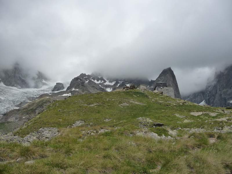
continue to rise for the apparent path that does not budge, but rises more steeply for Pratoni up to a junction between "Short" and "Long". We follow the left is clear that the Court must also be short to be steep but without the problems we face and soon we view the imposing shelter Cà d'Asti share in 2854. Perfect it took us only 1h 20 '.

We stopped about 25m to "fulfill physiological needs, munching a bar and drink a sip of water and put a heavier mesh because the chilly wind begins to make itself more this installment.

then allocate just behind the hut in the direction of the peak hours is clearly visible to the typical pyramid foma. Now the path is steep on stony ground and we are already well above the peaks around us so that in the distance already peeps Stone King (Mount Viso) and bursts through the clouds. After a while here we get to the Iron Cross 3.306m.

Perfect ... we are in good shape. Not at all hungry, the fee does not create any problem and then climb the remaining 232m back to the top missing.

From here begins the stretch a little more challenging and then equipped with fixed ropes per chi ne avesse bisogno che con una ripida salita ed alcune svolte ci porta fino alla vetta.

Eccoci qui...sono le 11.25 e siamo già in vetta. Ci abbiamo messo 2h 40' che togliendo i 24' di sosta fanno 2h 16' per salire i più di 1.400m di dislivello...non male...possiamo essere soddisfatti.

Dalla vetta il panorama è impagabile e spazia a 360° dalle valli del Cuneese dominate dal Monviso, alle valli Olimpiche con lo Chaberton, alla Francia con i ghiacciai della Barre des Ecrin, alla Valle d'Aosta con il Monte Bianco, il Dente del Gigante e la Grandes Jorasse per continuare con il Gran Paradiso, il Cervino e il Monte Rosa, fino a chiudere con la Pianura Padana con Torino e l'inizio della Valle di Susa con la Sacra di San Michele.

Qui vediamo il Dente del Gigante (a sx) con la sua particolare forma appunto a dente scuro perchè senza neve.

Approfittiamo dell'apertura del Santuario per una preghiera di ringraziamento per essere arrivati fin quassù, una firma al registro di vetta e poi possiamo goderci il sole, il panorama e uno spuntino.

Pian piano le nuvole cominciano ad addensarsi ai nostri piedi e in poco ci ritroviamo isolati dal mondo...siamo noi soli sopra le nuvole.
Nostri compagni sono il sole, le montagne, le cime innevate, i ghiacciai e un carpet of clouds that makes us feel small. Little Men in the sight of the wonders that only nature can create.

The dream did not last long, the voices of other hikers us back down to earth.
I'll never understand how one can be in contact with so beautiful 'instead of starting, and pause to enjoy it in full, to fill your eyes and heart to keep the lasting impression, you lose to mention the more mundane topics like had at the bar and more loudly.

We stop at the top enough. Only around 14:30 we decided to go down. By now the clouds have completely closed the view of the valley and descending vediamo che si sono attestate a quota 2.850 ovvero all'altezza del Rifugio Cà d'Asti.

Da qui in giù infatti viaggiamo immersi nelle nuvole a tratti decisamente dense e ciò rende il percorso molto affascinate ma la dice lunga sul fatto che in montagna bisogna andare sempre attrezzati per ogni evenienza visto che il tempo cambia velocemente soprattutto alla alte quote.
Le nuvole ci accompagnano fino a quota 2.100 ovvero all'auto.
E' stata una giornata fantastica, quasi non siamo stanchi o meglio siamo talmente pieni di forti emozioni, di immagini mozzafiato che non sentiamo i muscoli duri, i piedi stanchi e la pelle arrossata dal sole.
Un trekker che si rispetti non può not be increased at least once a Rocciamelone.
Mine was the second time but I promised myself to come back every year and I suggest you do the same.
If any of you would like to try the experience of staying on top once let me know that we are organized.
Good mountain to all